Coal Network Update for Friday, May 12, 2023
OPERATIONAL PERFORMANCE
BNSF has made significant progress this past week in restoring service on flood-affected subdivisions in the Midwest. Last week, operating teams responded to a flood-related track outage on the upper portion of our Hannibal Subdivision, which runs adjacent to the Mississippi River north of St. Louis. The track, which has since been restored, was out of service for ten days due to multiple floodgate closures. Flooding also caused multiple washouts on our Aurora Subdivision, which runs between La Crosse, Wisconsin and Aurora, Illinois, last week. Traffic was rerouted until crews restored service to the impacted track. Thanks to the efforts of our BNSF teams and contractors, service performance is improving as train flows on the network continue to normalize.
As we have reported, we continue to implement an aggressive plan to hire additional employees. We have about 740 train crew team members that graduated from training and are on the job, 900 that have been hired and are in training and an additional 400 candidates have accepted an offer and are in the pre-employment screening process.
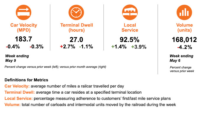
With this positive momentum, we remain focused on generating additional improvement in the coming weeks. Regarding key service metrics, average car velocity decreased slightly versus the prior week and month. Terminal dwell remains slightly above the average level for the prior week but is lower than April. Our local service compliance measure, which reflects our timeliness in handling carload freight, has increased and now exceeds 92 percent.

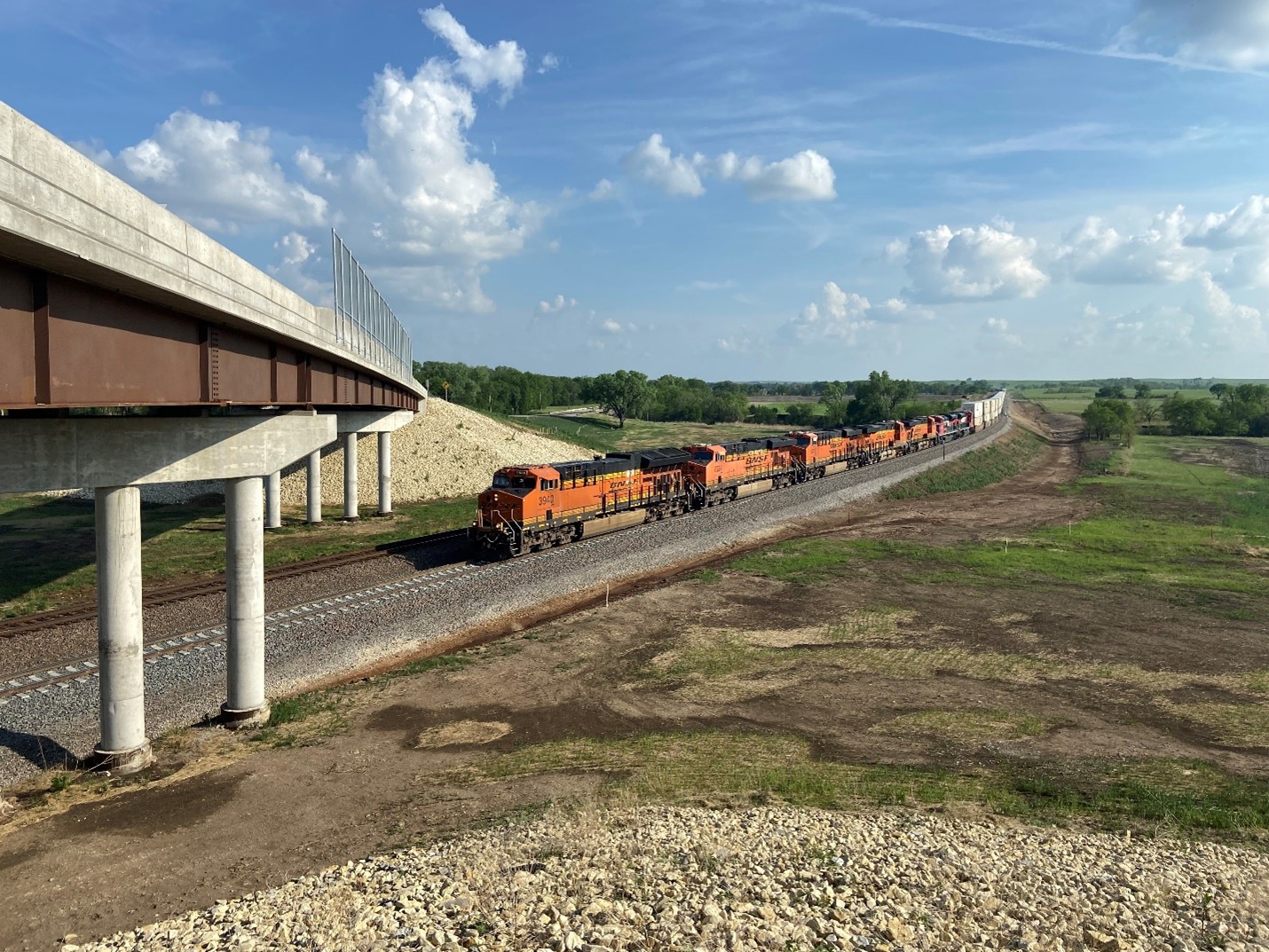
We finished installing a nine-mile segment of double-track on our Emporia Subdivision in eastern Kansas this week. This is part of a multi-year initiative to construct about 50 miles of new double track to support traffic growth on our Southern Transcon route connecting the West Coast and the Midwest.

The first train to travel on the new mainline near Bazaar, Kansas
SERVICE EXPECTATIONS FOR THE WEEK AHEAD
BNSF continues to monitor the risk of flooding across the network. Flood watches are currently in effect in west-central Texas and Oklahoma. A slow-moving weather system stretching from the Texas/Oklahoma border to Mexico is expected to bring severe thunderstorms and heavy rain to the area through the weekend. More than a foot of rain is possible in some areas as well as hail and the potential for damaging winds up to 80 mph.
Flood warnings and watches are also in effect in parts of Wyoming, Colorado, Nebraska and Kansas, as excessive rainfall is possible as a storm moves across the Central Plains today.
Summer-like temperatures with highs 15-25 degrees above the historical average are forecast in the Pacific Northwest and inland California, accelerating the potential for rapid snowmelt. BNSF engineering teams are prepared to respond and continue to watch flood-prone areas such as the Lake Tulare Basin in California’s San Joaquin Valley. California’s historic rainfall this year has caused the dry lake to refill and raised concerns that flooding will continue as the record snowpack in the Sierra Nevada mountain range melts over the rest of the spring and summer.
We thank you for your business and appreciate the opportunity to serve as your transportation service provider. We welcome your feedback and questions.